For the last 73 years, the Pakistani state has argued that Pakistan and Pakistanis cannot exist with the ‘K’ of Pakistan (Kashmir) becoming a part of the country. Kashmir, also referred to as Pakistan’s ‘jugular vein’ or ‘unfinished business of Partition’ has been the rationale for massive defense budgets, four wars with India, and Pakistan becoming Jihad central thanks to the support the Pakistani deep state has given jihadi groups and radical Islamists for decades.
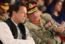
On August 5, 2019, India revoked Article 370 and changed the internal boundaries of the erstwhile state of Jammu and Kashmir. For one year Pakistan’s response comprised speeches by Prime Minister Khan, COAS Bajwa and Foreign Minister Shah Mehmood Quraishi on various fora. Yet Pakistan was unable to convince the international community to take action against India.
One year later on August 4, Pakistan announced that it was releasing a new map that included Indian Occupied Kashmir.

What soon became evident to most experts is that this was actually the official map of Pakistan from 1950, the only difference is that at time it included East Pakistan.

Prime Minister Imran Khan while releasing the map stated “It is a historic occasion. The political map reflects our national aspiration and supports our principled stance on Kashmir dispute.” Foreign Minister Shah Mehmood Qureshi said that the “Line of Control had been extended and connected with the Chinese border. This makes it clear that Siachen is ours.” xxx hot movies
That 73 years after independence, the only response the Pakistani state can take is to start a map dispute with India demonstrates their lack of options and policy. Cartographic victories are not victories. Also, Junagadh and Manavdar never belonged to Pakistan so retaining them in every official map does nothing but fool the millions of Pakistanis.
![]()


